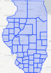

We who live in the 21st century find it difficult to imagine that the counties we live in now have not always been in existence. For example, before Illinois became a state in 1819, some of the downstate counties extended as far north as Wisconsin and Minnesota.
Ten years later, in 1829, Illinois’ northern counties were still very much unformed; the area now known as Lake County was in fact part of Putnam County.
Changes in county boundaries can have a serious impact on genealogy research and it is imperative to know when boundary changes took place. A family may be listed in one county for one census, then ten years later they seem to be located in another county, without moving all; the original county was probably divided or the boundaries changed in some way. An additional concern is always where the records are kept; usually the records stay in the seat of the county that produced them, but when the name or boundary of the county changes, the records will most likely stay in the original county.
So how can you determine what county your ancestor lived in when the boundaries changed? Here’s where the beauty of The Atlas of Historical County Boundaries comes in, making it easy to see, as well as find out, when boundaries changed. The interactive map offers images of each boundary change throughout the state. Chronologies describe rather than show the changes to state and county boundaries, making it easy to determine the dates. For GIS and map geeks, the maps may be downloaded for use in Google Earth, ArcGIS Explorer, or ESRI’s for-pay products.
The Atlas of Historical County Boundaries was created from data originally published by the Newberry Library in a book series of the same name and funded by the National Endowment for the Humanities. Bookmark this site and put it in your genealogy tool box. You are sure to use it at some point in your research.
Categories: Genealogy
Tags: Genealogy
