If you’ve looked through early Libertyville telephone books or browsed the newspapers, you may have come across some unfamiliar street names. Maybe you’ve searched Google Maps and they’re not there.
Here’s a few long forgotten street names from the downtown area:
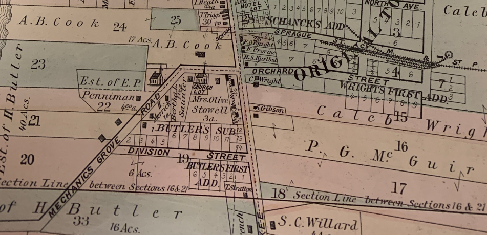
Sprague Street (now East Cook Avenue)
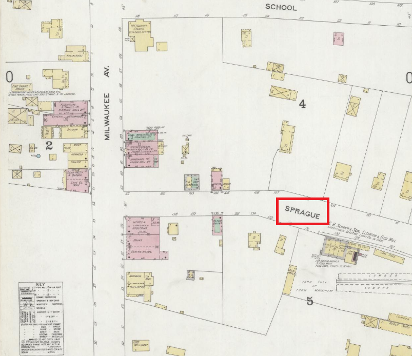
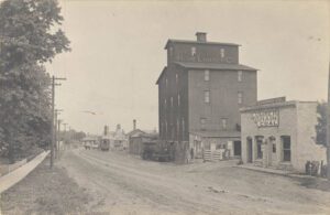
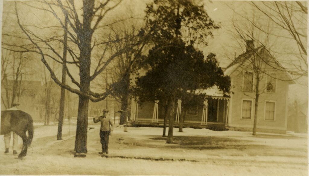
Sprague Street was named after Lyman Sprague (1807-1867), an early Libertyville merchant. His store was located on the northeast corner of today’s Milwaukee and East Cook Avenues. The Sprague home was just to to the east of the store [1].
Born in New York in 1807, Sprague came to Libertyville in the early 1840s. He established L. Sprague & Co., a mercantile business, in 1846. When Lyman was elected Lake County Sherriff in 1850, the business and family moved to Waukegan. After his term, they returned to Libertyville where he operated “Sprague’s Old Stand” until his death in January 1867. At the time of his death, he was Libertyville’s postmaster. After ten days with Edwin Parkhurst as interim postmaster, Emily E. Sprague, Lyman’s wife, was appointed to the position. She is one of only two women to serve as Libertyville postmaster [2].
When Ansel B. Cook subdivided land on the north side of his property to create Cook Avenue in 1897, the street name on the other side of Milwaukee Avenue remained the same [3]. The building that houses the Picnic Basket today was already there (built in 1894), so West Cook Avenue and Sprague could not align, thus giving us the familiar jog at that intersection.
Orchard Street (now East Church Avenue)
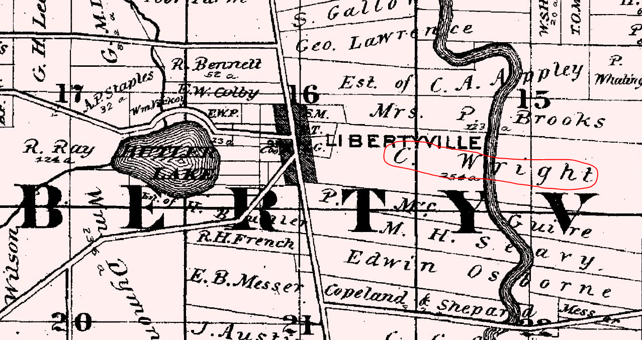
The name Orchard Street is found on the first Libertyville subdivision plat map filed on November 13, 1880, just five months after village incorporation. The land was subdivided by Caleb Wright who owned over 200 acres along Milwaukee Avenue [4].
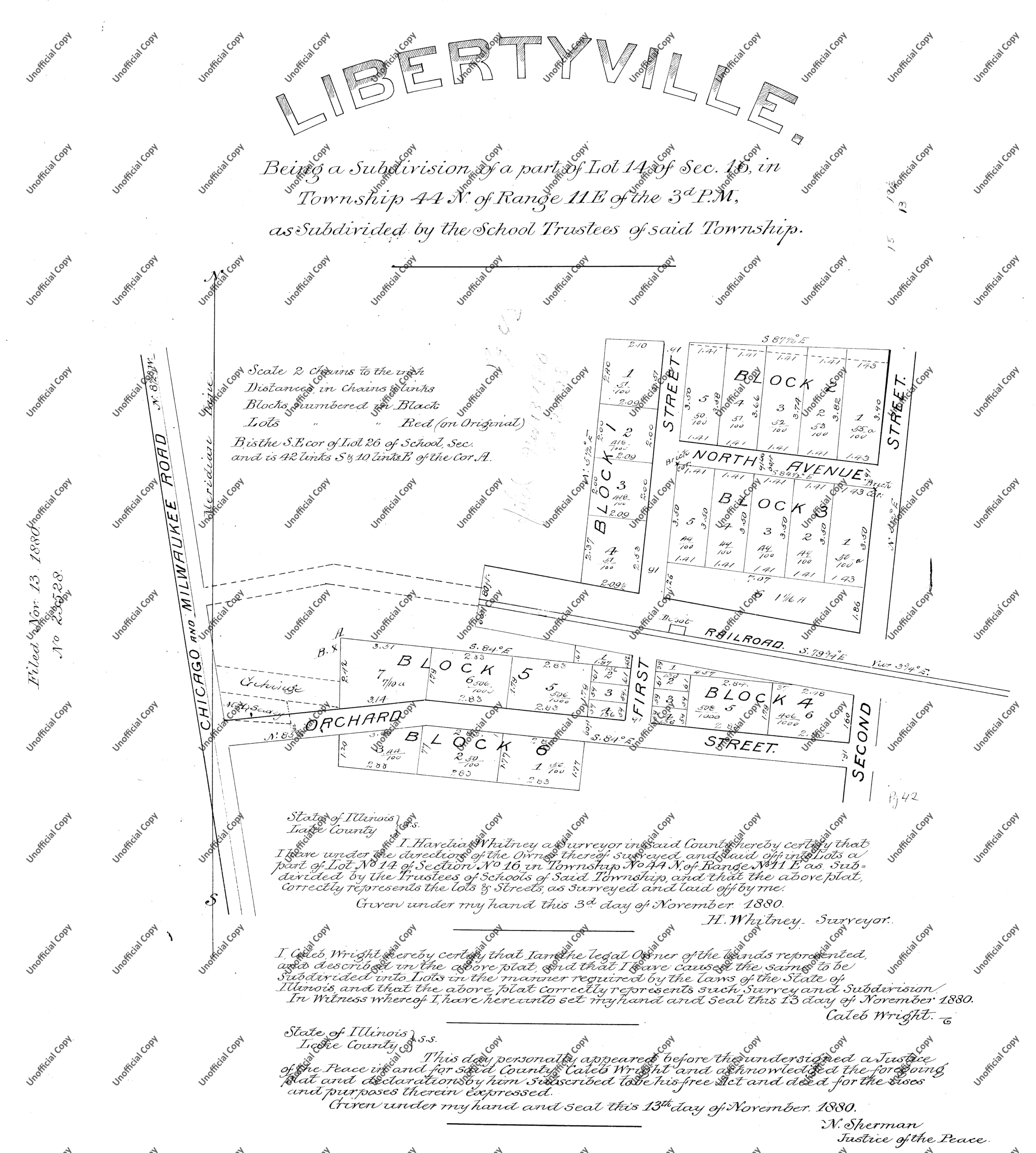
In a 1950s essay titled “The Growing Years,” local historian C.E. Carroll wrote that “Church Street was opened up east of Milwaukee Avenue and was called Orchard Street, since it ran through Caleb Wright‘s orchard, for his farm was then at the corner now occupied by the Public Service Building [BMO Bank, 2025] and ran clear through to St. Mary’s Road” [5]. Wright’s orchard was likely the inspiration for the street name.
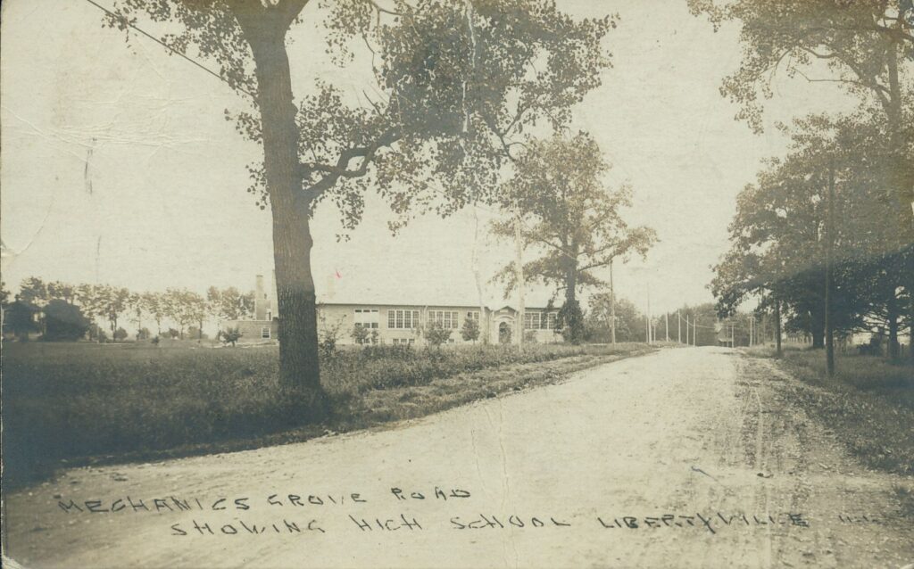
Mechanics Grove Road (now Brainerd Avenue, Park Avenue)
Mechanics Grove Road ran west from Libertyville to Mechanics Grove – the earliest name for Mundelein. The name is said to have referred to the occupation of the early European-American residents [6]. Many were mechanics, a name that could be applied to anyone who worked with their hands, including carpenters. Mechanics Grove Road began at Church Street and went southwest, approximately following today’s Brainerd Avenue to today’s Park Avenue. After taking a right-hand turn, travelers could follow Mechanics Grove Road west to the settlement of the same name.
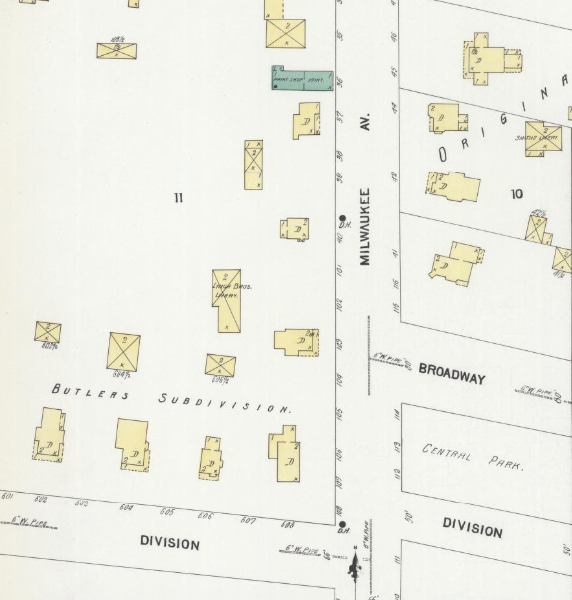
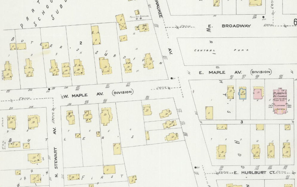
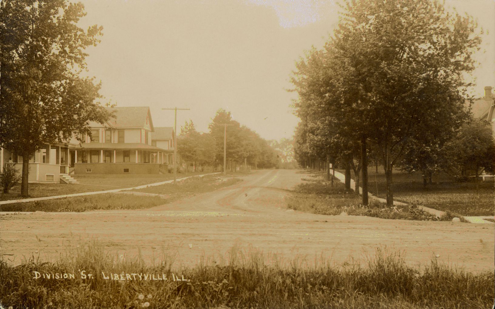
Division Street (now Maple Avenue)
The reason for the selection of the name Division Street is not documented. It may have been because it was the southern boundary or division of Butler’s Subdivision which was platted in 1874.
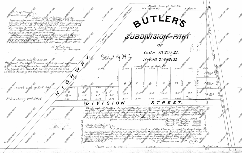
When the C. Frank Wright subdivision on the east side of Milwaukee Avenue was laid out, the street in closest alignment with the existing Division Street continued the name.
The earliest use of Maple Avenue in the local newspaper is found in 1921 [7]. By the time the 1924 Sanborn Fire Insurance map and the December 1924 telephone book were issued, the street names West Maple Avenue and East Maple Avenue were in official use. The name may have been chosen due to a string of maple trees lining the roadway.
Why did the street names change?
The streets discussed above were renamed in 1921 when the village was preparing for free mail delivery directly to houses and businesses. It was at this same time that street signs were put up and the Village of Libertyville passed an ordinance requiring all houses to be numbered to make mail delivery easier [8]. Despite these efforts, Libertyville was not granted free mail delivery service until 1926.
Sources:
- Carroll, C.E. “History of Libertyville.” Unpublished manuscript, ca 1955. Libertyville Historical Society collection.
- “The Death of Lyman Sprague.” Waukegan Weekly Gazette, January 19, 1867, p.3.; “Hon. Henry C. Hutchinson.” Portrait and Biographical Album of Lake County. Chicago, Lake County Publishing Co., 1891; “Lyman Sprague.” Illinois, U.S., Wills and Probate Records, 1772-1999. Ancestry.com Library Edition. Accessed September 3, 2025.; Postal history – Postmaster Finder, https://about.usps.com/who/profile/history/postmaster-finder/postmasters-by-city.htm. Accessed September 3, 2025.
- “Another Street – Will Extend from Milwaukee Avenue to Butler Lake.” Lake County Independent, October 30, 1896, p.1; “Cook Avenue.” Lake County Independent, April 16, 1897, p. 5.; Ansel B. Cook’s Subdivision. Plat of subdivision map. August 23, 1897. Lake County Recorder of Deeds.
- Libertyville. Plat of subdivision map. November 13, 1880. Lake County Recorder of Deeds; Lake County Atlas, 1873. Map. Lake County Maps Online, https://maps.lakecountyil.gov/mapsonline/.
- Carroll, C. E. “The Growing Years.” Unpublished manuscript, ca 1955. Libertyville Historical Society collection, https://vitacollections.ca/cmpldnewsindex/348/exhibit/7.
- Carroll, C. E. “Mechanics Grove Road.” Unpublished manuscript, ca 1955. Libertyville Historical Society collection, https://vitacollections.ca/cmpldnewsindex/380/exhibit/6; Dretske, Diana. What’s in a Name?: The Origins of Place Names in Lake County, Illinois. Lake County Discovery Museum, 1998.
- “For Sale.” Libertyville Independent, November 3, 1921, p. 8.
- “Local and Personal.” Libertyville Independent, January 6, 1921, p.5.; “Libertyville loses fight for free delivery.” Libertyville Independent, December 15, 1921, p.1.; “Additional Locals.” Libertyville Independent, September 1, 1921, p. 4.
Discover more from Cook Memorial Public Library District
Subscribe to get the latest posts sent to your email.
Categories: Local History
Tags: Local History